Hiking in northern New Mexico is special because it truly is a choose-your-own-adventure. Thanks to the elevation changes in the Sangre de Cristo mountains, you can go from desert hikes just south of Santa Fe to alpine lakes in just a couple hours of driving.
The trail to Nambe Lake is one of the best hikes near Santa Fe. Starting at the Santa Fe Ski Basin, the 3.3-mile trail winds up through aspen forest and along a cascade-laden stream up to the alpine lake. It has a little of everything: wildflowers, streams, mountain views, and great New Mexico camping opportunities.
Nambe Lake Trail Stats
Distance: 6.5 miles (roundtrip)
Camping? Yes.
Difficulty: Moderate to Hard
Elevation Gain: 2,073 feet.
Highest Elevation on Trail: 11,4000 ft.
Time: 4-5 hours
Distance to Trailhead from Santa Fe: 30 minutes
Best time of year: Spring through Fall. This is a high-elevation trail, so snow could impede hiking in the winter and early spring.
Getting to the Trailhead
Click here for Google Maps Directions to Winsor Trailhead
The hike to Nambe Lake begins at the Windsor Trailhead at the Santa Fe Ski Basin. Only 30 minutes outside of Santa Fe, the road up to the trailhead switchbacks up in elevation through the Santa Fe National Forest. The curvy road produces beautiful views of aspen-covered mountainsides, chartreuse in the spring and gold in the fall.
The road up to the trailhead passes by several campgrounds, including the Black Canyon campground (USFS) and Big Tesuque Campground. The twisty road is dotted with overlooks and scenic views, as well as trailheads to other hikes in the area.
At the end of Hyde Park Road, the Winsor trailhead sits by a huge parking area at the ski hill. There is a vault toilet at the trailhead, as well. From the vault toilet area, head northeast up the Winsor trail (35.79561, -105.80486).
Hiking to Nambe Lake, New Mexico
Trailhead to Pecos Wilderness Boundary
From the trailhead, take Trail 254 to the northeast. Trail 254 winds through Englemann spruce and white fir through the arid Santa Fe National Forest. The trail crosses a powerline right-of-way and is a mostly gradual climb up to the wilderness boundary.
At the boundary to the Pecos Wilderness, there is a walk-through gate and a sign-in notebook for hikers entering the wilderness area. The trail distance from the trailhead to the wilderness gate is 0.75 miles.
Pecos Wilderness Boundary to Rio Nambe
From the wilderness gate, the trail stays on a mostly flat/downhill sidehill for 1.4 miles. The flat terrain allows you to really take in the beautiful aspen forests surrounding the trail. Each tree in an aspen stand is connected to its neighbors, making aspens the largest single organisms on Earth!
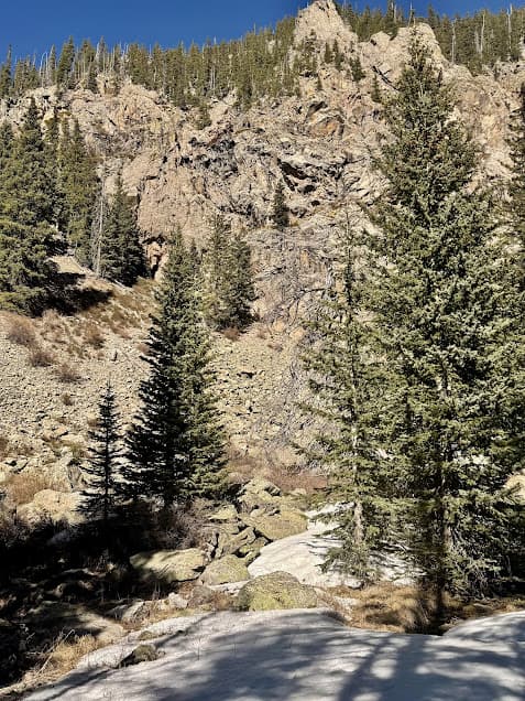
In addition to the shiitake-colored trees directly on the hillside the trail passes through, this part of the trail also offers great views of the surrounding mountainsides and Santa Fe Baldy (12,621).
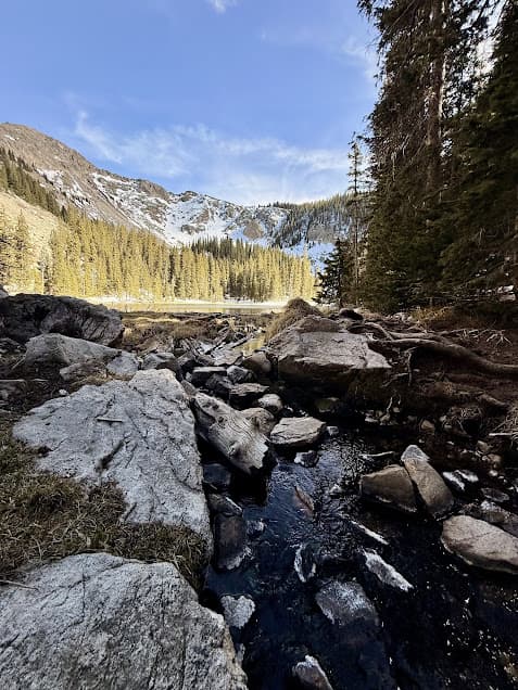
Rio Nambe to Nambe Lake
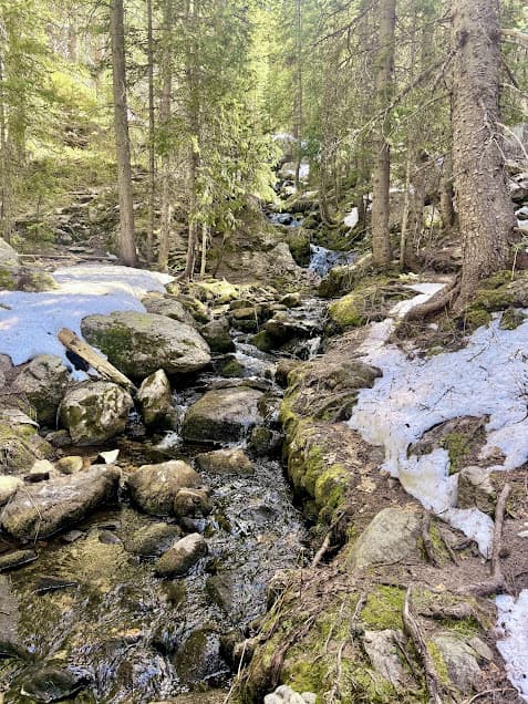
When you get to the stream called Rio Nambe, the trail splits.Take the right fork and follow the creek to the southeast.
The chortling Rio Nambe is a small stream that drains the valleys off of Raven’s Ridge and Nambe Lake. While the hike here isn’t too steep, there are still multiple small cascades in the Rio Nambe as it makes its way down to Nambe Reservoir.
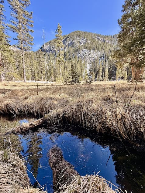
The trail along the creek can be slightly tricky to follow at times, but continue along the Rio Nambe all the way up to the lake. Along the way, the trail passes a large wet meadow. Just before the final climb to Nambe Lake, the trail pops out into a woodline along rocks and scree, flanked by tall rock walls. That’s when you know you’re almost to the lake! The section of trail along Rio Nambe to the lake is 1 mile.
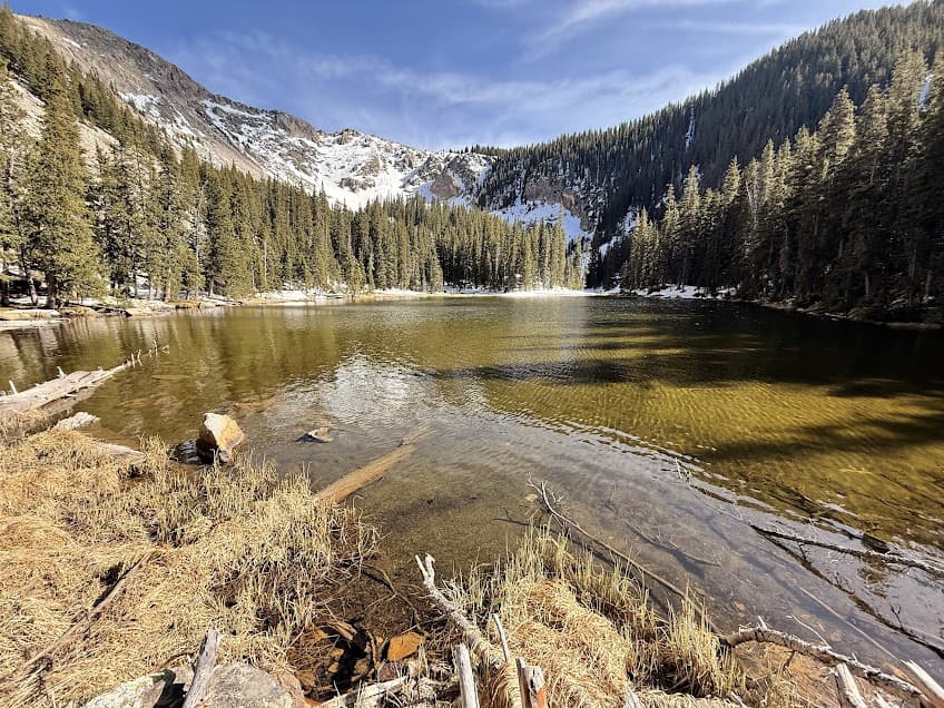
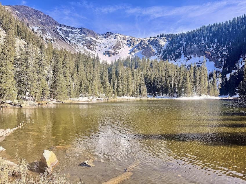
Nambe Lake: A New Mexico Alpine Lake
While Nambe Lake itself is small, it is a beautiful little lake ringed by mountain peaks that can hold snow into the summer months. The lake is perched at 11,400 feet and is filled by snowmelt from the Sangre de Cristo mountain range. Along the way, you might see the white blooms of Howell’s marsh marigold. Beds of grouse whortleberry flank the trail with lime green spindly stems. Common birds along the trail include jays and juncos.
Mountain Peaks Above the Cirque
Rising from the backside of Nambe Lake is Lake Peak (12,349 ft) and Deception Peak (12,329 ft). Both peaks are easily climbed when accessed from the Santa Fe Ski Area. From Santa Fe or Albuquerque, Lake Peak is an easy and accessible 12,000-foot peak and a great option for beautiful views of the Santa Fe National Forest.
Fishing in Nambe Lake
We did see trout in Nambe Lake, but did not get a good enough look to tell which species they were. This was in early spring when there was still snow covering a lot of the trail, but the lake at this time was ice-free.
Camping and Backpacking in the Pecos Wilderness, New Mexico
Camping is allowed in the Santa Fe National Forest and the Pecos Wilderness, but campsites must be 100 feet away from water. You could certainly make the hike to Nambe Lake into a Sangre de Cristo mountains overnight backpacking trip. Finding a flat spot to camp away from water might take some creativity, but is definitely doable.
Camping Near the Nambe Lake Trailhead (Car-Camping)
There are multiple formal campgrounds in the area, including:
- Black Canyon Campground
- Big Tesque Campground
- Aspen Basin Campground (small, but right at the trailhead).
Trail-Specific Hiking Safety Considerations
The top safety considerations for hiking to Nambe Lake include:
Summertime thunderstorms
Summertime afternoon thunderstorms are a fact of life in the Rocky Mountains, so prepare for storms when hiking later in the day. Luckily, most of the trail is below treeline and it is quite possible to avoid exposure on this hike.
Altitude sickness
Since the trail tops out over 11,000 feet, some hikers may feel the effects of altitude up at the lake. To avoid this, stay hydrated, acclimate slowly over time, and go lower in elevation if the effects of the altitude at the lake are too much.
Injury walking over terrain
Microspikes and hiking poles are both great tools to have when hiking to Nambe Lake in the early spring when snow still covers most of the trail. Another hazard related to snow is the final section of trail across the rocks below Nambe Lake. When snow obscures the rocks, use caution when your feet break through the snow and catch down in between rocks. No ankle injuries allowed!
More Hikes Near Santa Fe Ski Basin
From Hyde Park Road, you can access a ton of trailheads and link up between many of the various trails in the Santa Fe National Forest. Some other notable hikes right in this area include:
Raven’s Ridge Trail (6 miles)
Tesque Creek North Fork Trail (3.7 miles)
Santa Fe Baldy via Winsor Trail (13.6 miles)
More Hikes in the Rocky Mountains and Southwest
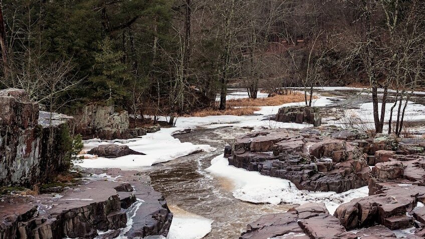
Missouri/Fancy Lakes Loop Trail (Colorado)
Paint Mines (Colorado) – a good stop if traveling up I-25
The Grand Canyon’s South Rim (Arizona)
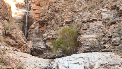
Seven Falls (Arizona)
Trail Fuel: Santa Fe Food Recommendations
Before or after the hike, hit up Santa Fe for an amazing array of restaurant choices. We tried:
CrashMurderBusiness for coffee. Specifically because of the creative drink names, each of which is named after the fancy made-up names for groups of animals. (Think: crash of rhinos, murder of crows, business of ferrets). I got the “Murmuration of Starlings”, which had rosemary and thyme in the drink. Not too sweet, great way to caffeinate before the hike.
Pantry Rio for lunch or supper. If you want green chile, they have them. On a turkey and pesto sandwich. Or a burger. Hits the spot!