The Goat Rocks Wilderness in south-central Washington is a super popular backpacking destination for those looking to experience the gorgeous alpine of the PNW. Unlike some of the other amazing backpacking routes in Washington such as the Enchantments, the Goat Rocks Wilderness does not currently have a lottery system for hiking. This is great for spontaneous trip planning, but some areas do experience overuse.
There are more than 100 miles of trail in the Goat Rocks Wilderness. The Pacific Crest Trail runs through the heart of the wilderness area, and can be accessed from other connecting trails. We only had two nights in our schedule to work with, and were trying to keep daily mileage relatively low. You could easily plan a much longer route within the Goat Rocks, but if you are limited to a weekend, the route we did hit a lot of the highlights in the wilderness area.
How to Plan A Backpacking Route (DIY!)
How to Save Money on Backpacking Gear
Goat Rocks Backpacking: What to Know
Permit: Free wilderness permit is required to enter the Goat Rocks Wilderness. These permits are available at kiosks at the trailhead access points to the wilderness area. To park at the Berry Patch trailhead or the Snowgrass trailhead, a Northwest Forest Pass or America the Beautiful pass is required.
Parking: Parking at the Berry Patch and Snowgrass trailheads is crowded. There are outhouses located at both trailheads.
Vehicle Clearance: The forest service road from Randle, Washington is well-maintained. There are a few potholes but a 4×4 vehicle is not required.
Water Availability: The Goat Rocks has plentiful water due to snowmelt even into late summer.
Insects: The mosquitoes and flies were nonexistent on this route in late July. However, they can be bad in certain areas and especially earlier in the summer.
Kids and Pets? This route would be great for older kids (10-12 and up). Pets are also allowed.
Challenges: This area is extremely popular and crowded. Get up there early to find a campsite, and use your very best Leave No Trace behaviors.
Two-Night Backpacking Route in the Goat Rocks Wilderness
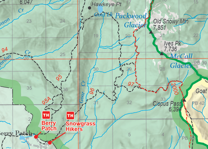
Day 1: Berry Patch Trailhead to Goat Lake (5.7 miles)
Our goal was to get an early start up to Goat Lake since it is such a popular spot. We thought that by going mid-week, the crowds wouldn’t be so bad, but there were still a lot of people and both trailhead parking lots were nearly full (on a Tuesday!). We camped at the small campground at Chambers Lake the night before heading into the wilderness.
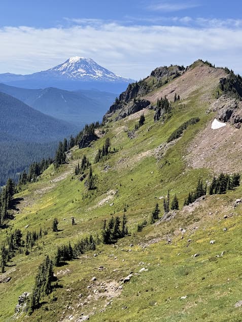
After obtaining free wilderness permits at the trailhead kiosk, we entered the Goat Rocks Wilderness! From the Berry Patch trailhead, we took the Goat Ridge trail northeast into the wilderness area. I would definitely suggest taking the small Goat Ridge Lookout trail that makes a small detour but then hooks back into the main trail. The views were stunning and you get your first look at Mt. Adams and Mt. Rainier.
Goat Ridge Trail to Goat Lake
After the lookout trail, the Goat Ridge trail climbs along the edge of Jordan Basin. This is the head of a drainage and there are plenty of small creeks for water here. The July morning we hiked through Jordan Basin, it was sun-drenched and full of wildflowers. The trail then climbs over the steep North Goat Ridge for views of the opposite basin. Mt. Adams is a prominent companion along the trail toward Goat Lake.
Just after crossing over the ridge, there is a small wooden trail marker. To the left is a detour up to Hawkeye Point, which is definitely worth the little hike and scramble. Hawkeye Point sits up above Goat Lake, and you’ll have views of both Mt. Rainier and Mt. Adams, as well as the turquoise lake below.
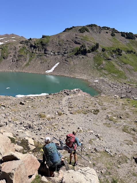
Camping at Goat Lake
Once you get to Goat Lake, it would be a good idea to start looking for a campsite. There are small campsites all over just down from the lake. Most of them are clustered around the limited vegetation and tree cover. We got up to Goat Lake fairly early, around 10 am, which was good timing since the previous night’s campers were packing up but the influx of new backpackers had not arrived yet. Camping at Goat Lake can become very congested. Leave No Trace is especially important with the amount of heavy use this beautiful place gets.
Day 2: Goat Lake to Lily Basin Trail and PCT Detour (~8 miles)
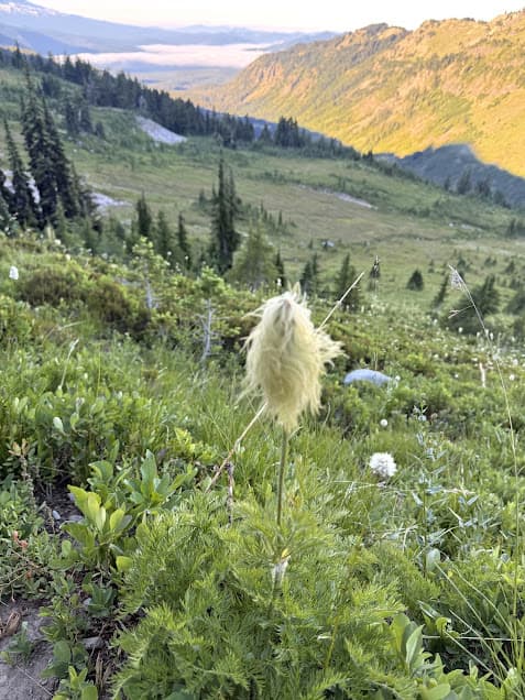
The Lily Basin Trail heading south from Goat Lake was like walking through a bowl of Fruity Pebbles cereal in late July. The indigo-colored Rainier Pleated Gentian, lupines, pink mountain heather, and Indian paintbrush created lush rainbow carpets around small rocky streams. The tall, conical bear-grass lily swayed in the breeze. My personal favorite flower in the northwest is the Western Pasqueflower, which looks like it came straight out of a Dr. Seuss illustration.
Bypass Trail to PCT and Old Snowy Mountain
When the Lily Basin Trail reaches the junction with the Snowgrass Trail, there are several campsites tucked among the trees. Trail #97, the bypass trail, connects the Snowgrass Trail to the Pacific Crest Trail. There are also campsites along this stretch of trail. The trip over to the PCT and north among the alpine habitat it passes through is well worth it. The trail showcases incredible views of Mt. Adams, and plenty of bold marmots among the rocks.
We hiked the PCT up toward Old Snowy Mountain, which included some mild snow crossings in July. Just below Old Snowy Mountain, the PCT traverses the “Knife’s Edge”, a steep and rocky section with views of Mt. Rainier, Mt. Adams and Goat Lake. Old Snowy and the Knife’s Edge are both exposed, rocky spines, so keep an eye on the weather when exploring these areas.
Wildlife in Snowgrass Flats Area
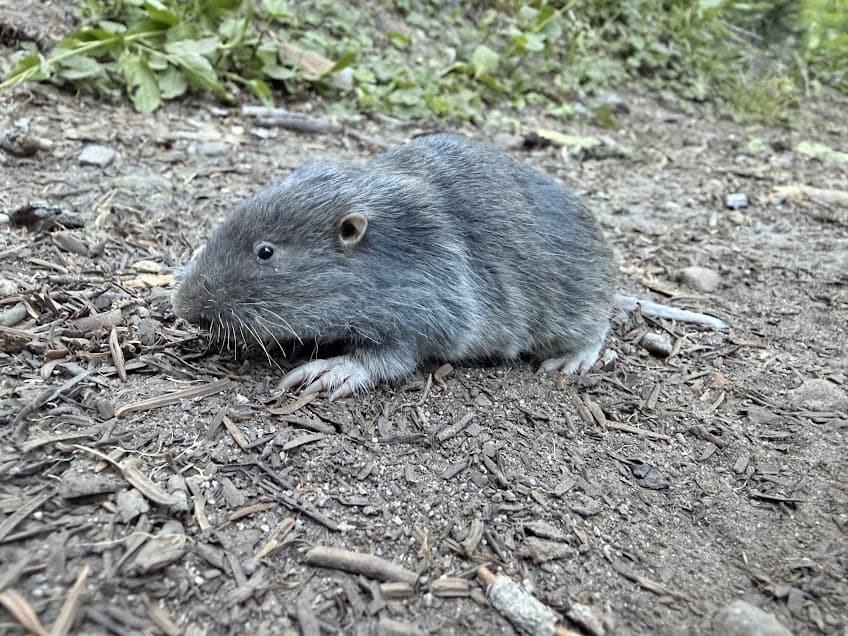
You could follow the Knife’s Edge down and/or climb Old Snowy Mountain from this point. We were trying to keep our mileage on the lower side, so we took in the views and then went back the way we came down toward the Snowgrass Trail. A grouse hen and her mostly-grown chicks were foraging along a brushy creek bottom here. In the morning, there was a pocket gopher on the trail–my first time seeing one above ground.
We secured a campsite near the junction of the Lily Basin and Snowgrass Trail and set up camp. The Canada jays seemingly appeared out of nowhere when it was time to cook dinner. A group of five bold birds moved between the trees and the ground, foraging for any missed crumbs or goldfish crackers we might have dropped. This behavior earned the bird the nickname “camp robber”, but they are also known to many people as a Whiskey Jack. This name came from the Cree word wisikejack, referring to a wise trickster.
We spent the evening exploring the wet meadows along the Lily Basin trail. Breeding frogs, unique wetland plants such as the curve-beak lousewort, and little potholes full of tadpoles all made their home beneath the talus slopes from which pika scolded. There are mountain goats in the Gifford Pinchot National Forest, but we weren’t lucky enough to see any.
Day 3: Snowgrass Trail to Snowgrass Trailhead (~4.6 miles)
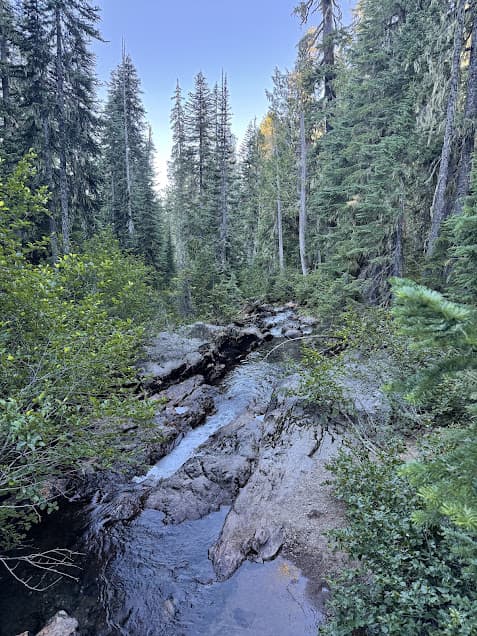
The final day’s hike back to the trailhead is a downhill, easy walk. The highlight of the Snowgrass Trail here is Snowgrass Falls, which you will hear from the trail. It’s a pretty, hidden forest waterfall at the corner of one of the switchbacks.
The Snowgrass Trailhead is right next to the Berry Patch Trailhead, which makes this route a convenient loop. You can easily walk back to your parking spot at Berry Patch from the Snowgrass TH.
More Pacific Northwest Hiking!
Goat Ridge Trail to Goat Lake Hike
Beacon Rock in the Columbia River Gorge