
On a sunny June evening, it was hard to tell just how sunny it was while enveloped in the maple tree canopy of the northern stretches of Michigan’s Porcupine Mountains. Padding up the Little Carp River trail, I moved from dark shade into splotches of sunlight as the trees thinned near the small river. As it grew progressively later in the evening, the true U.P. inhabitants of darkness (mosquitoes) emerged from their daytime resting places, seeking out my ankles and shoulders for a B-Positive dinner.
This was another excursion into the Porkies during my pursuit of training for a 100-mile ultramarathon. I had battled blowdowns and mud for the previous miles to the west on the Lake Shore Trail, clocking 15-minute miles of navigating around obstacles.
The fern-choked bottomland forest along Lake Superior was a welcome reprieve and I was finally able to pick up the pace. A handful of Nerds Gummy Clusters at the bridge over the mouth of the Little Carp River was both a reward and fuel for the next 6 miles of journeying south along the river.
Little Carp River Trail Quick Stats!
Distance: 5.8 miles one-way, 11.6 miles out-and-back
Vertical Gain: 830 feet
Difficulty: Easy, except for two river crossings where your feet might get wet.
Time required: 5 hours
Permit required: Recreation Passport
Dog-friendly? Yes, but should be kept on a leash.
Kid-friendly? Yes!
Highlights: Nice views of the river, small cascades/waterfalls, bridge and Lake Superior access at the northern end of the trail
Little Carp River Trailhead
The best way to access the Little Carp River trail directly is from a trailhead off of the South Boundary Road in Porcupine Mountains Wilderness State Park. In the winter, South Boundary Road is closed to vehicle traffic.
Click here for a Google Maps link to the trailhead.
Hiking the Little Carp River Trail
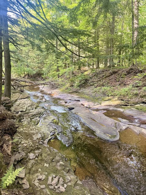
From the trailhead, the trail follows the Little Carp River north on its journey to Lake Superior. The Lake Superior shoreline in the Western U.P. is striated by rivers of all calibers emptying the land to the south into the largest of the Great Lakes.
Just beyond the trailhead off of South Boundary Road, there are two small waterfalls on the Little Carp River: Greenstone Falls and Overlooked Falls. The Greenstone Falls cabin, which visitors can book for overnight stays, is situated right above the river here. Just down the trail past the cabin is LC-5, a backcountry campsite in a wide, flat grove of large trees above the river.
Backcountry Campsites and River Crossings
From here, the trail parallels the north side of the river, full of overlooks down into the vegetation-rich riverbottom and rolling terrain through old hemlock forests. There are an additional three backcountry campsites along this stretch of trail (LC-6, LC-7, LC-8).
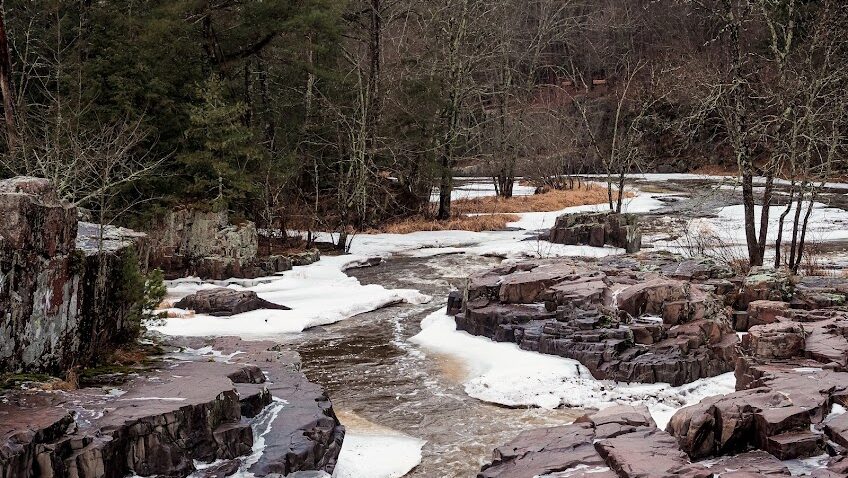
Around 3.75 miles into the hike, the trail crosses the river just above Trappers Falls. Be prepared to get your feet wet; there are no formal bridges to use for river crossings. LC-9 is a nice little backcountry site right along the river at this point.
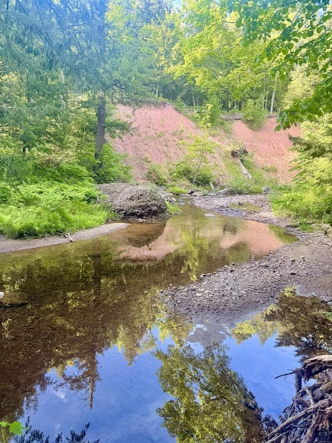
The trail continues for another mile along the river’s left side, heading north toward Lake Superior. There are a few other small cascades along this stretch, including Explorer’s Falls. At the 4.8-mile mark, the trail crosses the river again. The water is deeper here than the first crossing, but there are larger rocks available for the crossing.
Traders Falls and Mouth of Little Carp River
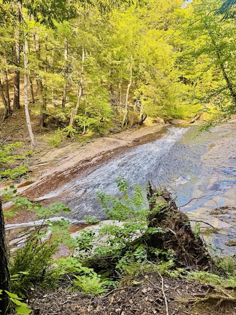
At the 5.3-mile mark, Traders Falls is a spot on the Little Carp River where the water flows over wide, flat rock on its final sprint up to the lake. The last part of the hike is the most scenic part of the hike. Here, the river flows into the lake just beyond a well-built bridge. There are many backcountry campsites in this area: LC-11 through LC-14, and LS-4 and LS-5. The Little Carp Cabin, available for rent, is also located just above where the river shakes hands with Gitche Gumee.
For a map of all backcountry campsites and cabins in the Porkies, click here.
Porkies Flora and Fauna
Little Carp River Trail Plants
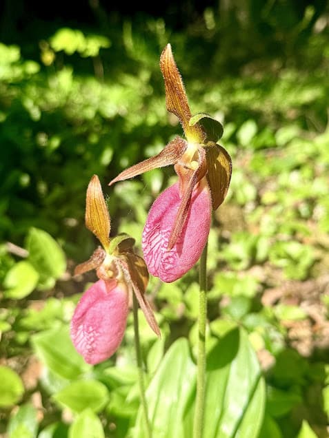
In early June, the pink lady’s slipper orchid, also known as the Moccasin Flower, blooms throughout the north woods, including the Porcupine Mountains. The large, pink orchids are striking and can grow up to 17 inches tall. The Lake Superior basin is actually quite rich in orchid species diversity. Many of these species are more diminutive and grow in wetland habitats, but the showy pink lady’s slipper can be easily seen just hiking along some of the woodland trails in the Porkies.
The white-flowered thimbleberry plant grows readily along the Little Carp River. In the same Rubus genus as raspberries, the plants produce soft, seedy red berries that are great used in jams.
The cool forest-loving bluebead lily is another common species in this area of the Porcupine Mountains. In June, the plants bloom small yellow lily flowers, and produce blue berries later in the year, although they don’t taste good at all.
Little Carp River Trail Wildlife
On my hike along the Little Carp River trail, I heard/saw American redstarts, ovenbirds, and sharp-shinned hawks. White-tailed deer browsed the lush vegetation in the river bottoms. I even noticed a week-old wolf scat full of deer hair and bone shards on the trail.
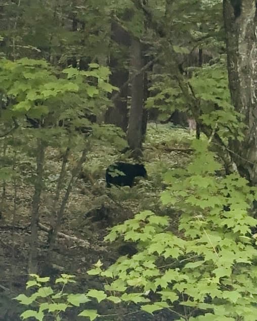
Just past the trailhead on South Boundary Road, I startled a black bear that didn’t quite know what had spooked it. It looked past me, up the road, and then ambled off toward the river. Keep an eye out for beavers along South Boundary Road, as well.
More Porcupine Mountains/U.P. Hikes Nearby
Escarpment Trail, Porcupine Mountains Wilderness State Park
Pingback: See the Apostle Islands Sea Caves from Above: Hiking Guide - the lupine