
For hikers who love to stare at maps, planning a backpacking route in the Holy Cross Wilderness of Colorado’s White River National Forest is a great way to flex some creative route-planning muscles. The 150 miles of trails through the wilderness area provide plenty of options for routes of any length. The Holy Cross is peppered with high-elevation cirques that nestle the snowmelt into glassy lakes, many of which you can hike to on an out-and-back route.
The Best Backpacking Route in the Holy Cross Wilderness
Half Moon Trailhead to Fall Creek Trail
For a 32-mile “out-and-back with a bonus loop”, start at the Half Moon Trailhead at the top of Tigiwon Road and head down Fall Creek trail. From Half Moon Trailhead, you can either head up the Mount of the Holy Cross trail to get to the 14,009-foot peak, Notch Mountain, and East Cross Creek, or take the Fall Creek trail straight south from the trailhead.
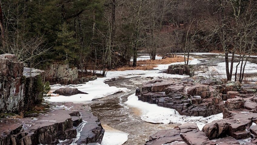
Fall Creek trail steadily climbs ~1500 feet through spruce-fir forest (look for snowshoe hare) and some open meadows where it flattens out a bit by Lake Constantine. Just past Lake Constantine, the trail forks. The right fork heads up to Tulhare Lakes; the trail here includes a pretty steep section over and through boulders but the lakes are worth it. Just down from the Tulhare Lakes is a spectacular spot to camp as long as you are more than 100 feet from any lakes or streams. Camping regulations can be found on the USFS page for the Holy Cross Wilderness.
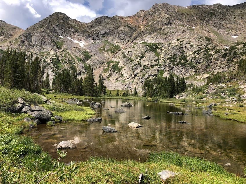
Camping Below Lower Tulhare Lakes
From camp, the hike up to the lakes takes you up and over the 12,000-foot mark and past the Lower Tulhare Lakes falls. Lower Tulhare Lake has some top-notch basking rocks for backpackers and marmots.
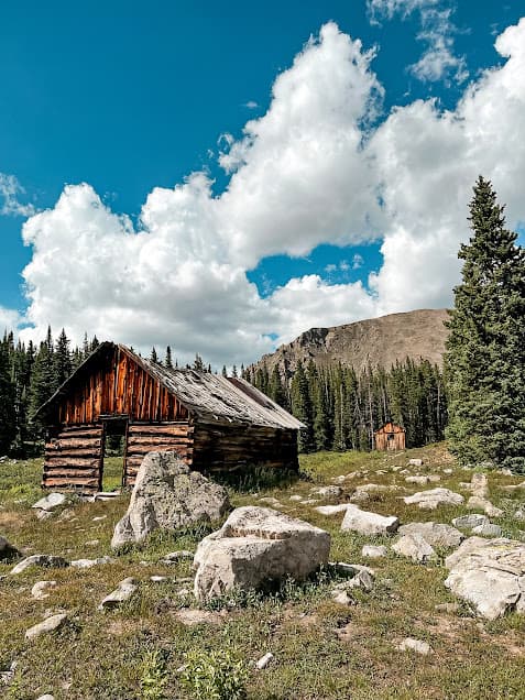
Holy Cross City – An Abandoned Town in the Wilderness
To include the Missouri Lakes and Fancy Lake in the “loop” part of the out-and-back, continue down Fall Creek trail another 4.5 miles to Hunky Dory trailhead. This trailhead is for a Jeep trail that goes to the abandoned Holy Cross city. There are still a few old log buildings in a meadow along the trail.
Hiking Along Fancy Creek to the Missouri Lakes/Fancy Pass Trailhead
The Jeep trail turns into the Fancy Lakes spur trail, which brings you to the loop part of the route. Left is all downhill along Fancy Creek, which has some beautiful overlooks of the roaring stream all the way down to the Missouri Lakes/Fancy Pass trailhead. From the trailhead, the hike west up along the south part of the loop toward Missouri Lakes is another stunning section of trail with ample opportunity to filter water. In late summer, access to drinking water is not usually a concern on the hike outlined here, at least in my experience.
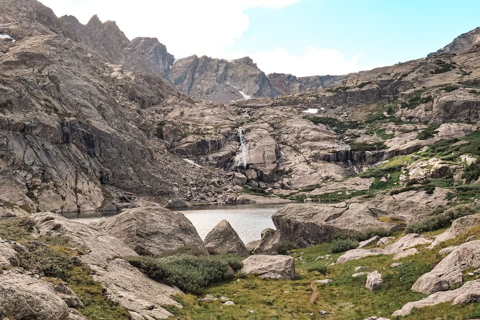
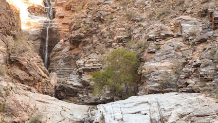
The Missouri Lakes and Missouri Pass – A Highlight of the Route
The Missouri Lakes are one of the most scenic parts of this route. After heading up in elevation from the trailhead, the topography flattens out here and the trail winds among the cluster of lakes and spruce/fir. There are also some good campsites in this area, and enough room to spread out from other people.
From the Missouri Lakes, to complete the loop we have double passes! Uphill from the Missouri Lakes is a steep and rewarding climb over Missouri Pass.
Side note: The Cross Creek trail links up here, so you could always add in some additional trail miles by heading down that trail to camp. Taking the 15-mile trail all the way down to the Cross Creek trailhead is another option but would require a 7-mile hike up Tigiwon Road back to the Half Moon trailhead if you have only one vehicle there. Parking one at the Cross Creek TH and another at Half Moon could be a good shuttle route to avoid the road hiking section.
Excellent Views at Fancy Pass and Fancy Lake
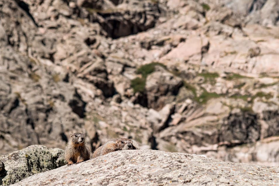
To continue back up and over Fancy Pass, the trail goes through sweeping views of the Cross Creek valley below and some boulder fields with plenty of primo marmot-spotting habitat! The top of 12,398-foot Fancy Pass has some of the best views on the whole route. Heading back down from Fancy Pass, the trail is very rocky, barren, and has some lingering snow even late into the summer. It is only a 0.6-mile hike down to Fancy Lake (green-hued, reflects mountains, what more could you ask for?) from the pass.
From here, the loop part of the route is complete. To get back to Half Moon Trailhead, hike the “back” part of the “out” described earlier. The best part about this particular out-and-back is that it’s pretty much downhill to the trailhead, which allows for completely different vistas, scenery and a solid workout for the quadriceps.
Backpacking Safety Notes in the Holy Cross Wilderness
The number one safety concern for this route would be late-summer storms, which should be taken into account for any higher-elevation Colorado hike. Try to plan your hike to avoid the exposed passes (Missouri and Fancy) during the afternoon times when storms are most likely to blow in.
Altitude sickness can also be a factor in having an enjoyable time; going from a lower elevation straight to camping at 11,000 feet can make for a rough night if altitude sickness is an issue for you. Hydration and electrolytes are your friend.
Pingback: How to Plan a Sweet Backpacking Trip - the lupine
Pingback: Hiking Colorado's High Country: Missouri/Fancy Lakes Loop Trail - the lupine
Pingback: How to Hike Mount Massive, Colorado’s Heftiest Fourteener - the lupine