
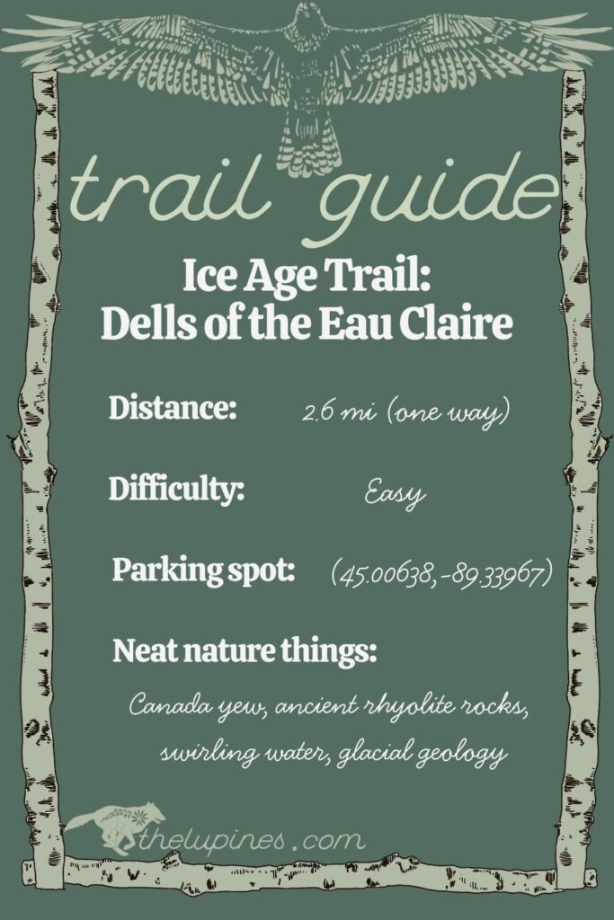
The Ice Age Trail in central Wisconsin has quite a bit of county road mileage (beautiful nonetheless!). So, hikers get a treat when the trail makes its way off the pavement and onto some dirt. The 2.6-mile (one way) Dells of the Eau Claire River segment of the Ice Age Trail is a treat and one of the most unique segments of the IAT in central Wisconsin.
Getting to Dells of the Eau Claire County Park
Located 15 miles east of Wausau, most people complete this segment as a day hike from the Dells of the Eau Claire County Park. Here at the park, there are parking areas on both the east and west sides of county road Y. Better yet, the park includes campsites, a beach and shelter.
Hiking the Dells of the Eau Claire section
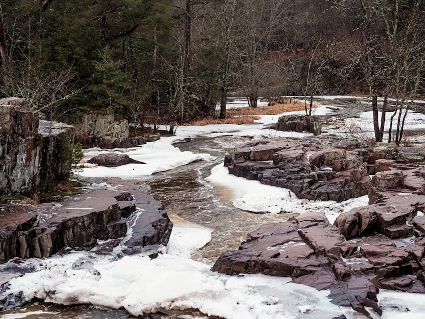
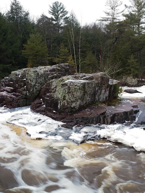
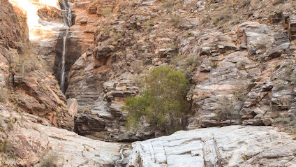
From the bridge on County Y, you can choose to follow either side of the river to the west. Right here close to the bridge is where the river puts on the most spectacular show of the hike, tumbling through the rhyolite rock formations and churning through gaps in the rock. In the winter, ice formations twist into intricate carvings chiseled by the water of the Eau Claire River. The swirling water and sediment have carved potholes into the rhyolite that are still being excavated by the river’s whirlpools.
Flora and Fauna of the Ice Age Trail
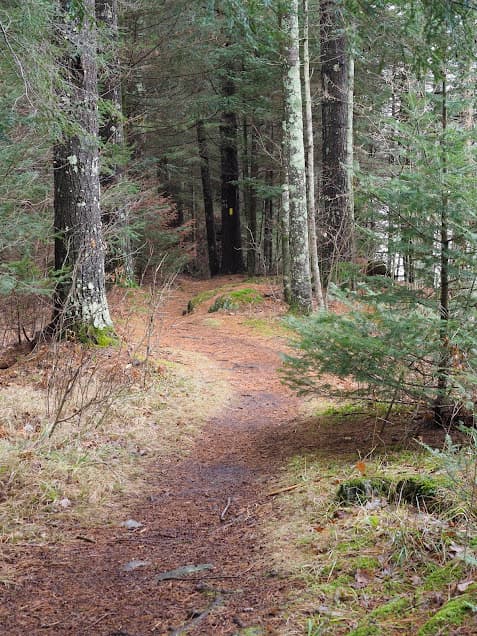
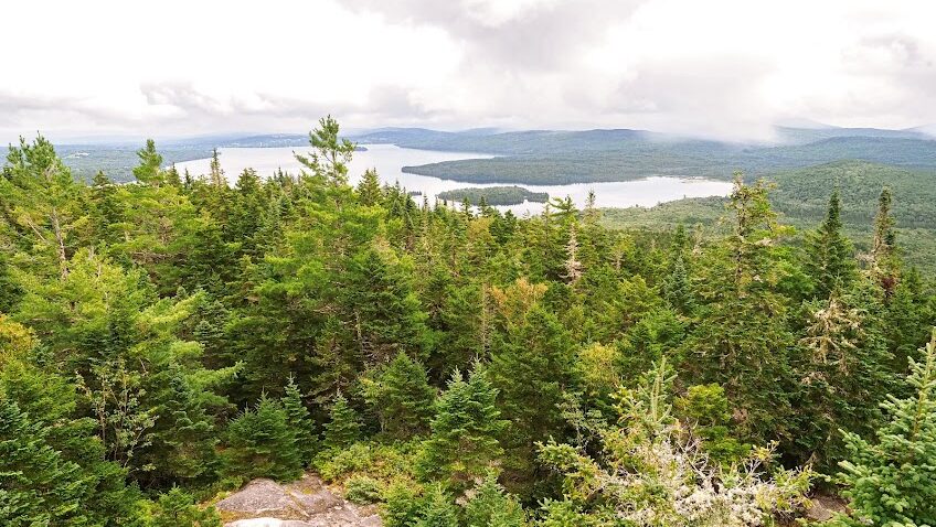
Downstream from the aquatic orchestra that makes up the waterfalls of the dells, the river takes on a peaceful demeanor. Here, it flows through classic Wisconsin forest habitats of hemlock, Canada yew, birch and other northern mesic forest species. The slow-growing Canada yew used to be a common species across Wisconsin. Unfortunately, it experienced massive declines due to overbrowsing by white-tailed deer and landscape disturbance. On the Wisconsin’s Apostle Islands to the north, a few deer-limited islands maintain populations of Canada yew.
Footfalls on the bare dirt and needles on the downstream portion of the trail are soft, but the red-breasted nuthatches will keep you company. Sightings of otters, deer and turkey are the other rewards of a quiet walk along the river.
The Dells of the Eau Claire segment of the Ice Age Trail ends at County Road Z to the south. For most hikers, this is the turnaround point for those who choose to do this one as a day hike, although you can continue as far as you’d like. On the northbound hike, there is a bridge that crosses the river (you’ll have seen it on the outbound hike). Finally, crossing it will take you to the north side of the river and a different, higher vantage of the Eau Claire River and the waterfalls on the way back to the parking area.
Pingback: See the Apostle Islands Sea Caves from Above: Hiking Guide - the lupine
Pingback: Hiking the Ice Age Trail: Mecan Springs to Bohn Lake - the lupine
Pingback: Wisconsin's North Country Trail: Copper Falls State Park - the lupine
Pingback: The Best Spots to See Cranes in Wisconsin - the lupine