
Mount Sopris may not be a fourteener, or even a thirteener, but it is absolutely the most beloved twelver in Colorado’s Roaring Fork valley. The big mountain dominates the vista to the west coming up the valley on Highway 82 between Glenwood Springs and Aspen.
Hiking Mount Sopris is a 13.2-mile trip, with lakes, wildflowers and lots of talus at the top. With 4,400 feet of elevation gain over 6 miles, summiting Mount Sopris is challenging but totally doable. The trail to Mount Sopris is one of the best hikes near Aspen, Colorado!
Getting to the Trailhead
From I-70, exit at Glenwood Springs and go south toward Carbondale, Colorado on highway 82. At Carbondale, turn south on Highway 133 until you reach Prince Creek Road. There, turn left. Follow Prince Creek Road for 8 miles, and stay to the right, following signs for Dinkle Lake. The trailhead for hiking to Mount Sopris is at Dinkle Lake.
The trailhead is located at (39.303605, -107.1243474). Alternatively, type Thomas Lakes TH/Mount Sopris Trailhead into Google Maps.
Hiking Mount Sopris
From the trailhead, the trail goes south through the woods along an old road for 1.7 miles. After passing through the open meadow, the trail splits–take the right fork to head toward Thomas Lakes.
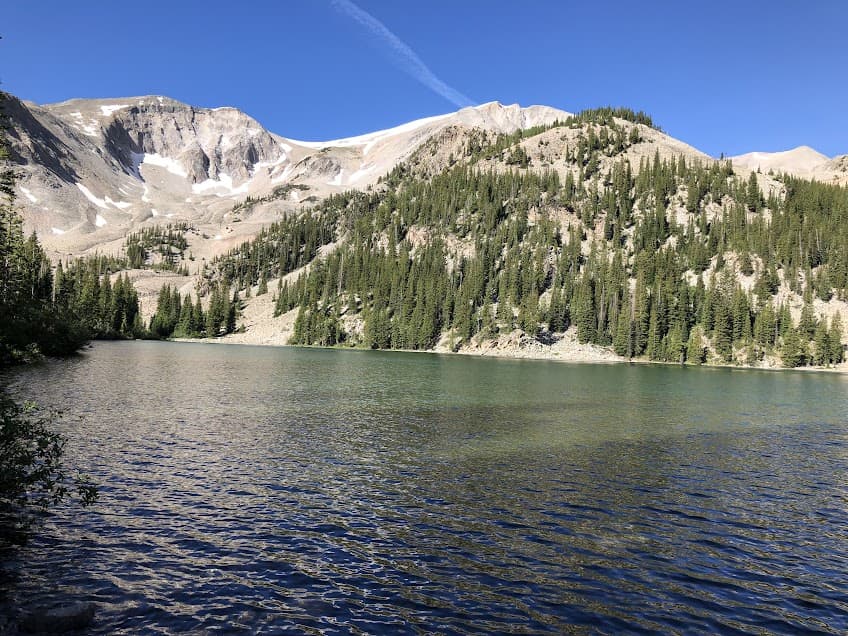
Thomas Lakes (Camping spot!)
The trail continues up through aspens to Thomas Lakes, 3.75 miles from the trailhead. The border of the Maroon-Snowmass Wilderness starts here at Thomas Lakes. To make the Mount Sopris hike into a backpacking trip, Thomas Lakes is the best spot to camp along the trail! Permits to camp in the Maroon-Snowmass Wilderness Overnight Zone are required and are available at recreation.gov. Thomas Lakes are pretty, mountain-ringed alpine lakes and are a welcome resting point before the big climb to the summit begins. To camp here, bear canisters are required to deter the nuisance bears in the area.
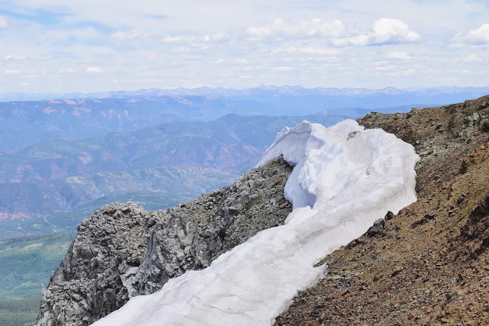
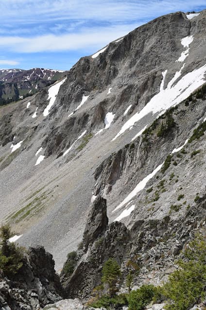
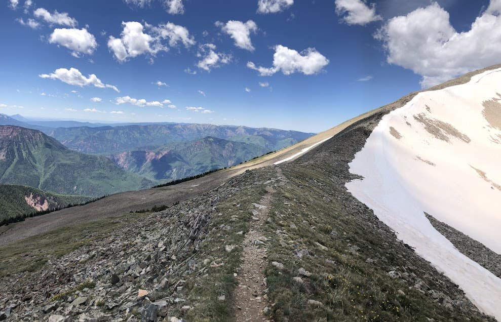
From the Thomas Lakes, there are some switchbacks above the south Thomas Lake and the trail really gains elevation as you move toward the summit. From Thomas Lakes, the trail gains 2,813 feet over the 2.85 mile hike to the summit of Mount Sopris. This part of the trail traverses a ridge over talus rocks, so be careful of thunderstorms that can hit when you’re on this exposed section of trail.
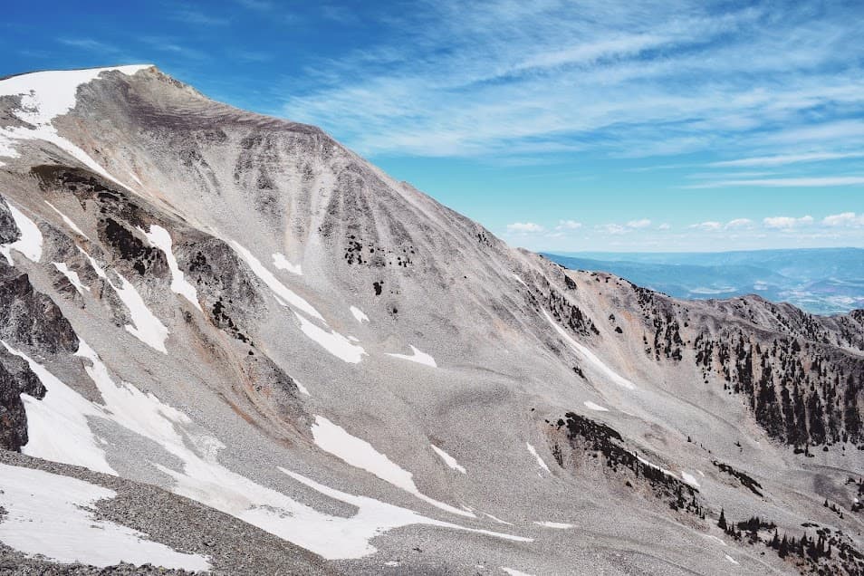
Mount Sopris summit and rock glaciers
The official summit of Mount Sopris sits at 12,965 feet–just shy of a thirteener. There are actually two summits on Mount Sopris, an east and west one. The East summit is the one you’ll reach first, and there is no trail to the West summit. However, it is a 0.7-mile walk to the West summit and can easily be completed to tack on some more views.
The summit of Mount Sopris gives views of the surrounding Elk Mountains and the Maroon-Snowmass Wilderness. One of Mount Sopris’s unique features is the rock glaciers that rest above the steep cirques to the north. A rock glacier is a glacier that is covered by rocks, but still melts slowly and therefore moves each year. The rock glaciers on Mount Sopris move about ten inches per year!
Safety on Mount Sopris
Like all Colorado big mountains, thunderstorms and lightning can pop up at a moment’s notice. Usually, these storms hit in the early afternoon. Getting an early start can allow you time to get to the summit and then back down below the treeline should an afternoon storm blow in.
Additionally, the Elk Mountains are noted for their steep faces, and falls do happen. Unfortunately, a pair of hikers fell on a nearby fourteener just a few days after we hiked Mount Sopris. Use caution in talus and along steep drop-offs.
Where to Stay near Mount Sopris
The best way to do Mount Sopris is to camp at Thomas Lakes! Turning the hike into an overnighter is a great way to get an early start to the summit by cutting the distance in half. You can beat the storms and even get some sunrise views along the way.
To the south of the turnoff to get to the Mount Sopris trailhead on Highway 133, the Bogan Flats Campground lies along the Crystal River. This campground is part of the White River National Forest, and is a peaceful spot to camp below aspens and Ponderosa. The Crystal River, a tributary of the Roaring Fork, has rainbow, cutthroat and brown trout in its waters.
In Carbondale, there is a Days Inn and a Comfort Inn.
Post-Summit Snacks! (The important part)
Breakfast in America in El Jebel is my must-have every time I visit the Roaring Fork valley. I have been getting their smoked salmon bagel breakfast sandwich for years, it clearly has made an impression on me.
The French fries at The Tipsy Trout in Basalt have served me well after getting out of the woods.
Summit celebration margarita? El Korita in Basalt has them, plus there is literally nothing better than a plate of Mexican food after a 13.6-mile hike.
Pingback: How to Plan a Sweet Backpacking Trip - the lupine
Pingback: Backpacking the Holy Cross Wilderness, Colorado - the lupine
Pingback: Paint Mines Colorado Guide: Prismatic Hoodoos on the Prairie - the lupine