
I’ve been lucky enough to spend a lot of time on Wisconsin’s Ice Age Trail over the past few years. Hiking, backpacking and trail running on the Ice Age trail fill a good chunk of my summer weekends and, fortunately, weeknights!
In the oak and pine-forested region of central Wisconsin, there are some lesser-traveled but beautiful sections of the Ice Age Trail. The topography here is rolling or flat for the most part. Even better, the section between Coloma and Hancock follows mostly dirt trails through state- and privately-owned land.
The 11.8-mile segment of the Ice Age Trail between Mecan Springs and Bohn Lake showcases rolling hardwood forests, steeply pocketed lakes nestled in the trees, and open grasslands and farm fields. This complete segment could be done as a long, 23.6-mile day hike or a one-way hike with a shuttle.
Hiking from Mecan Springs to Bohn Lake on the Ice Age Trail
Mecan Springs State Natural Area (1.4 miles)
To start from the south end of Mecan Springs State Natural Area, begin at the parking lot off of county Highway GG (44.05085, -89.47075). The trailhead is easily accessible from I-39, less than a 1.5-hour drive from Madison, Wisconsin.
To the south, the trail traces a short section of the Mecan River from a high vantage point. The Mecan River is a spring-fed trout stream that winds through various state-owned fishery areas. Eventually, it joins the Upper Fox River in Green Lake County.
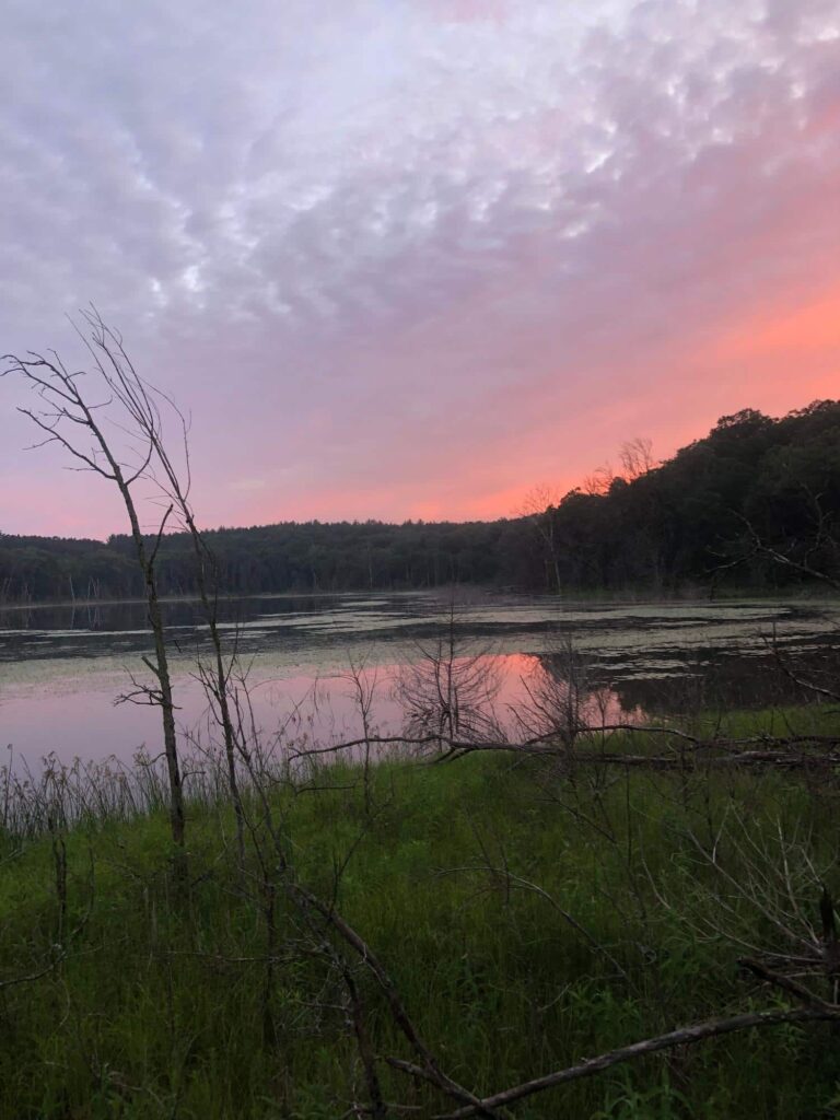
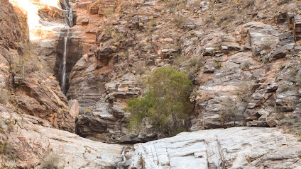
To the north, the trail enters Mecan Springs State Natural Area, a state-owned parcel that protects the headwaters of the Mecan River. The Ice Age trail traces topography along the south side of the spring. From the trail, the hillside drops down to Mecan Springs below. The Mecan Springs forms a 40-acre lake at the bottom of a moraine depression. A boat ramp on the north side of the lake gives fishermen access to bluegill, bass and pike.
With the steep topography and beautiful springs, this is a memorable section of the Ice Age Trail.
Mecan Springs to Greenwood Wildlife Area (2.7 miles)
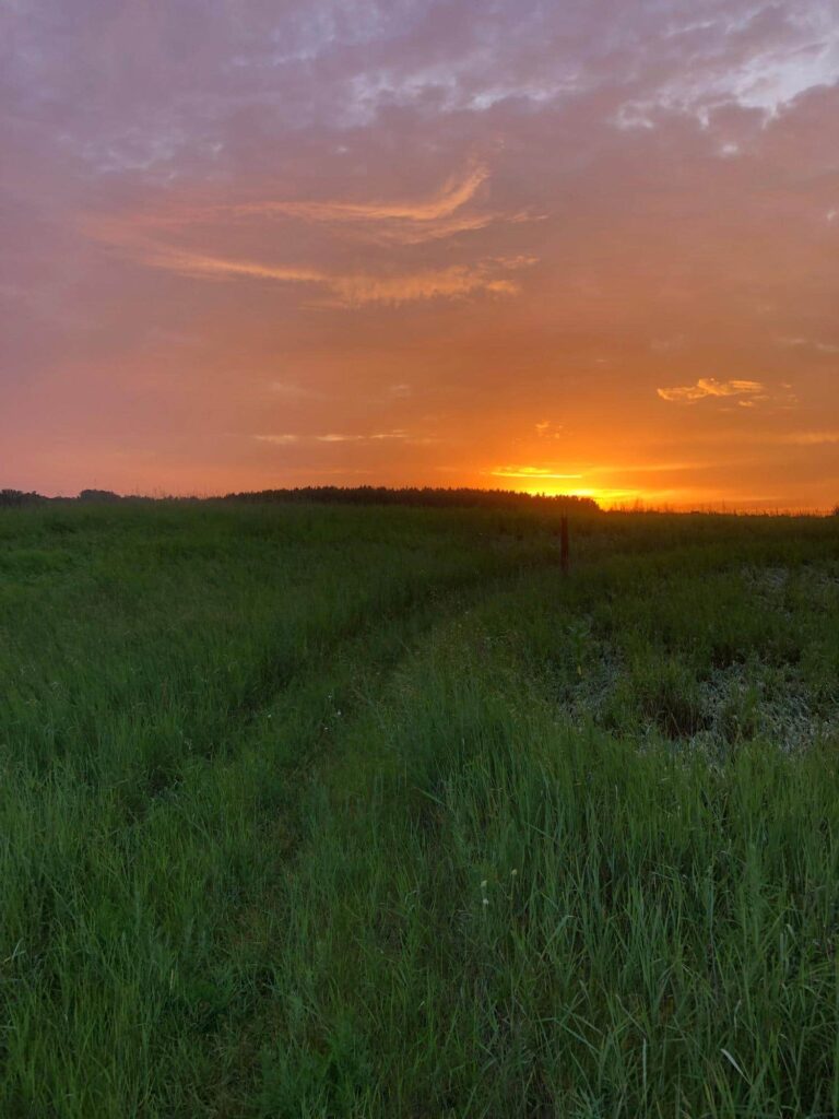
From the Mecan Springs parking lot on 6th Lane and Chicago Road (44.05871, -89.4855), the Ice Age Trail cuts straight north. The first mile of trail runs through grassland, so watch your footing. This is also a good spot to pick up ticks. The grasslands in this section bloom with wildflowers in the summer months.
After the grassland section, the trail passes through a section of pine woods. There is a dispersed camping area located in the woods on this property (44.06997, -89.49538). If you plan to make this hike into a long-distance, multi-night backpacking trip (per IATA regulation), the campsite is the only one in the area.
From here, the trail continues through the forest and then down a sandy lane to a 0.7-mile section of road. Bonus: Views of a pasture of longhorn cattle! From the road’s terminus at Bow String Drive, the trail enters Greenwood Wildlife Area.
Greenwood Wildlife Area to Browndeer Court (2.7 miles)
The section of the Ice Age Trail through Greenwood Wildlife Area starts off with a drop down to a small lake in the woods. This is probably the steepest section of the segment. After dropping to the lake, you are rewarded with a climb back out of the hole and into upland hardwood forest.
The trail crosses Browndeer Court at another parking area and then runs through the woods on the north half of Greenwood Wildlife Area. The trail peeks out at a huge grassland area where deer browse on summer evenings. It then pops back into the woods through managed forest and openings until it hits the road at Browndeer Court again.
Browndeer Court to Bohn Lake (5 miles)
After it leaves the oak forests and openings of Greenwood Wildlife Area, the Ice Age Trail follows Brown Deer Court east for a half mile. You get off the pavement again in a hilly section of hardwood forest where there is a good chance of seeing deer or turkeys. There is another parking area at the northeast corner of the wooded section, off of 9th Avenue.
The one mile section of 9th Avenue as the trail goes north is the longest road section of this segment. It is mostly hilly and wooded with some houses.
Once you reach the intersection of 9th and Highway C, the dirt trail picks back up as it winds through a grassy field. There is a small rocky section in the middle of the field, and it is a really pretty section to pass through in the early mornings and evenings.
Hiking the Bohn Lake loop
After another wooded portion of the trail, the trail crosses Highway B and enters the scenic Bohn Lake property. Bohn Lake is a 13-acre lake formed by running meltwater underneath a glacier during the last Ice Age. It’s considered a seepage lake today, and depending on the year the water level varies.
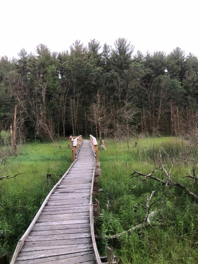
The trail traces the north edge of Bohn Lake, which is an excellent place to see wildlife, particularly birds and invertebrates. On the east end of Bohn Lake, there is a pretty wooden bridge and bench perfect for watching the sunset. If you want to loop all the way around Bohn Lake, there is a trail that goes around the lake!
There is no official parking lot off of 9th Avenue where the official Ice Age Trail meets the road again. Instead, there is one just a little further south off of the Bohn Lake loop trail. This would be an ideal spot to leave a vehicle for a shuttle. If you turn around here for an out-and-back, it would be a 23.6-mile hike.
Amenities Near the Ice Age Trail
The closest large town to this segment of the Ice Age Trail is Wautoma, Wisconsin. Wautoma has lots of gas stations, restaurants and coffee shops. A few of my favorites are:
- Silvercryst supper club
- Christianos Pizza
- KRB for BBQ
- Kwik Trip, Culvers and Dairy Queen for sweet treats!
Pingback: Hiking Wisconsin's Ice Age Trail: Dells of the Eau Claire River Segment - the lupine
Pingback: North Country Trail: Copper Falls State Park, Wisconsin - the lupine
Pingback: How to Save Money on Backpacking Gear: Spend vs. Save - the lupine