The Rangeley Lakes area of western Maine is an amazing area to explore for a little bit of everything the Appalachian region of New England has to offer. The big lakes with forested shores are great for fishing and boating, but for those with a bit more of a terrestrial bent and penchant for rugged, punishing terrain, there are endless hiking options in the area. Well, maybe not endless (you could go 1,977 miles on the Appalachian Trail from ME-4 to Springer Mountain, Georgia) but enough to get you by for a few months if you pack enough snacks.
Saddleback Mountain via Saddleback Ski Area
8 miles from Rangeley
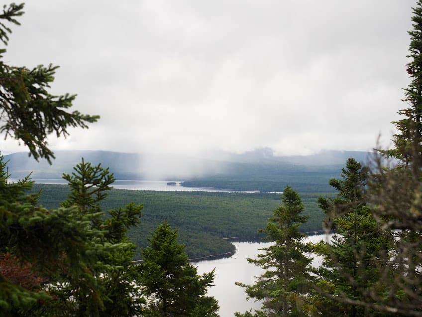
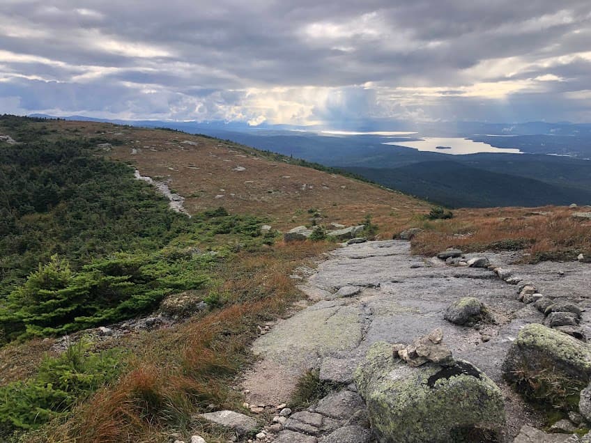
Saddleback Mountain is one of the highlights of the Appalachian Trail thanks to its break from the “long green tunnel” and alpine environment. To reach Saddleback Mountain from the AT itself, the Piazza Rock Trailhead is the closest access point to Rangeley. From that trailhead, the hike to the top of Saddleback Mountain and back is 13.3 miles roundtrip.
An alternative is to start at the lodge of the Saddleback Ski Area and just send it straight up the ski mountain on the Saddleback Hiking Trail. The trail gains 1,790 feet of elevation in just over 1.6 miles, but offers amazing views and an excellent workout.
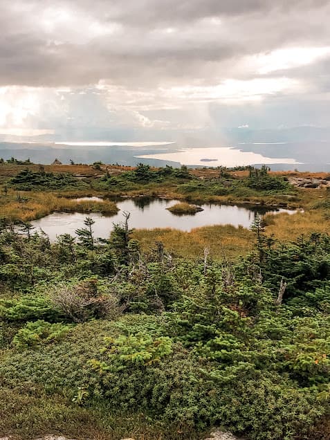
Saddleback Mountain itself is a gorgeous place to explore, showcasing an alpine ecosystem that is extremely rare east of the Rockies. The top of Saddleback is the second-largest alpine environment in Maine and is home to alpine plants like alpine blueberry and tufted highland rush. The low points in the rock fill with water and dot this section of trail with little ponds. It’s important to hike with care and stay on the trail here since this ecosystem is so fragile and doesn’t take too many errant boots to damage it.
After enjoying the hard-earned views and beautiful landscape on the top of Saddleback, bomb back down the ski hill for a total hike of about 3.5 miles (depending on how far on the AT you want to explore).
Appalachian Trail – Piazza Rock Trailhead
9.5 miles from Rangeley
The access point to the Appalachian Trail closest to Rangeley is the Piazza Rock Trailhead, nine miles outside of town on ME 4. From the parking lot, you can take the trail either northbound toward Saddleback Mountain (6.5 miles one way) or southbound toward Sabbath Day Pond and shelter (9 miles one way).
This hike can be as long as you’d like as an out-and-back in either direction. The Maine section of the Appalachian Trail is known for being particularly rugged and rocky, and this section is no different.
Bald Mountain Trail
10 miles from Rangeley
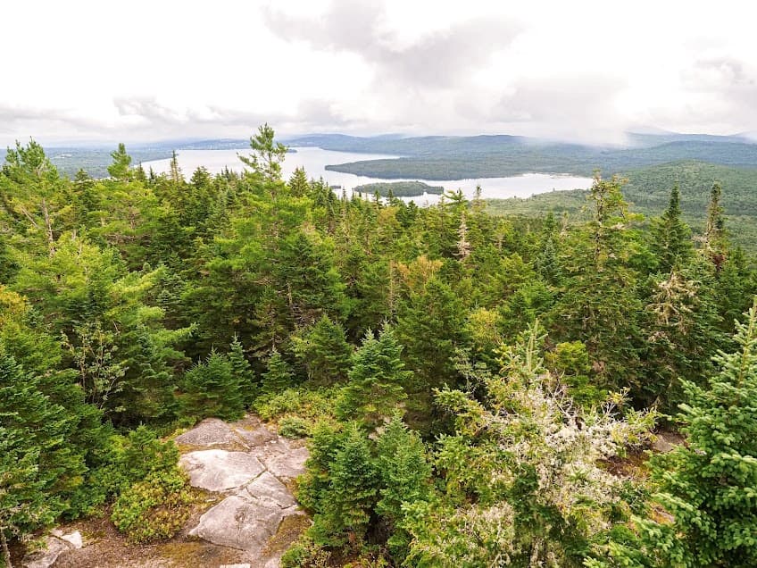
The Bald Mountain Trail near Oquossoc is the high point on the bridge of land that divides Rangeley Lake from Mooselookmeguntic Lake. The 2.3-mile hike passes through sugar maple hardwood forests and ferns for the first mile or so, then gets steep and rocky as the trail climbs over boulders through conifer forests to the top.
The top of Bald Mountain is crowned with flat expanses of rock, some picnic tables, and a 30-foot lookout tower that is a must-climb for beautiful views of the surrounding mountains and shining lakes. This hike is special because it crosses through so many different forest types in such a short distance, from hardwood to semi-alpine at the top.
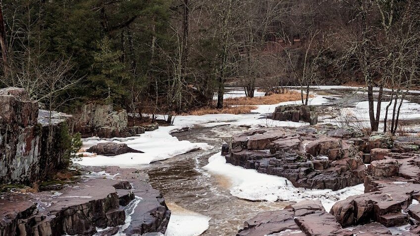
Cascade Stream Gorge Trail
3 miles from Rangeley
For an easier hike closer to the town of Rangely, the sweet Cascade Stream Gorge Trail showcases a beautiful waterfall and gorge along the Cascade Stream, which runs into the far end of Rangeley Lake.
The trail from the parking lot crosses a power line right-of way and then goes up along the stream with views of several cascading waterfalls. Bring good boots!